Hyde Park Barracks, Sydney
15 July 2018
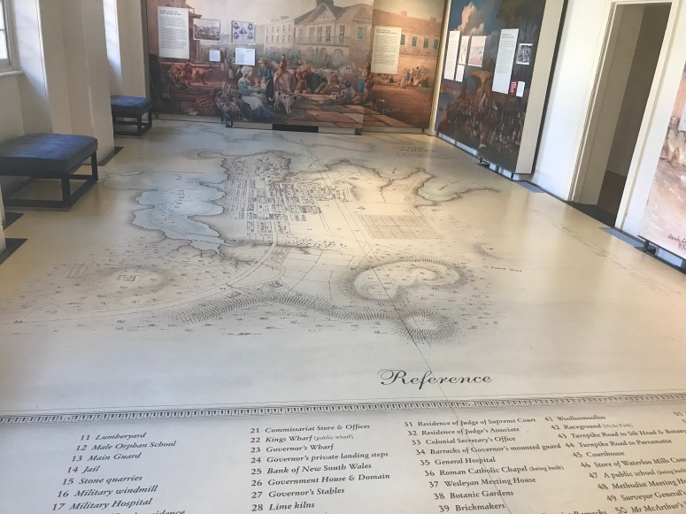
As with other penal heritage sites especially those related to convict transportation and the role of convict labour in colonial development, Hyde Park Barracks makes extensive use of maps throughout its exhibition. Notably there are huge floor maps on the ground floor which work to explain how present day Sydney evolved from its earlier function within the penal colony. This is a similar approach to the one taken at the Camp de la Transportation in Saint Laurent du Maroni with its ‘La Ville en chantier’ exhibition. The intention here is, to some extent, to validate convict labour in the making of the contemporary town and its infrastructure. The use of floor maps is also interesting in that they demand visitors to literal ‘walk over’ the re-presented history of the space Borges-style.
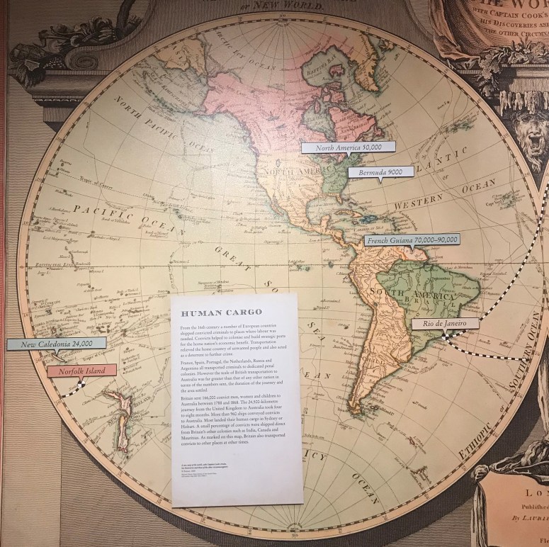
But the map that I found most striking at the Barracks was a large re-presentation of a map made in 1800 depicting the ‘Western’ and ‘Eastern’ Hemispheres. The map is used to mark the different European uses of convict transportation at various locations. This is interesting because it is possible to see French penal transportation in relation to other European colonial powers. Of course the main purpose is to emphasize the extent of transportation to Australia.